Points of Interest
Save, organise, and share important locations. Use private folders for personal use or shared folders to collaborate with your team instantly.
What Is a Point of Interest?
A Point of Interest (POI) is a saved GPS location with a name and an optional description. POIs are pinned on the map as flags in the colour of their folder, with their name underneath. You can have up to 10,000 POIs (100 folders × 100 POIs each).
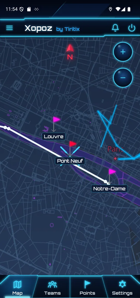
In this example, Louvre and Notre-Dame belong to the pink Paris sights folder and Pont Neuf to the red Favourites folder. The white line is an imported walking track.
Each POI also has a proximity radius in metres (50 m by default) which forms the boundary for GeoFencing alerts.
Creating a POI
POIs are always created at the map centre, marked by the cyan cross.
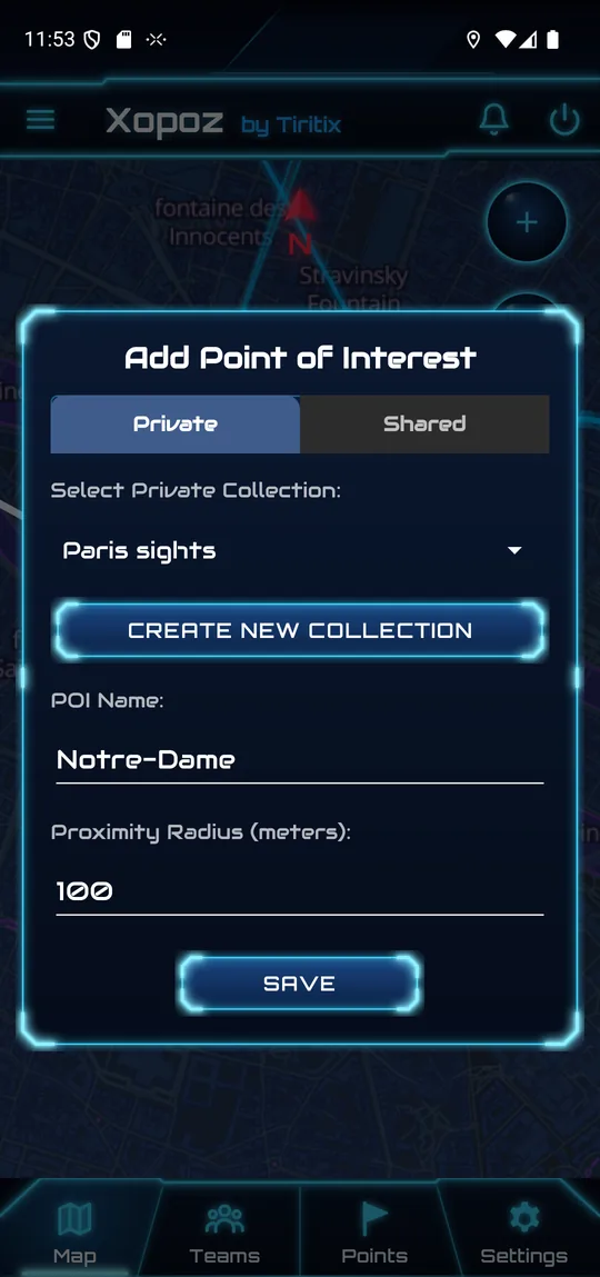
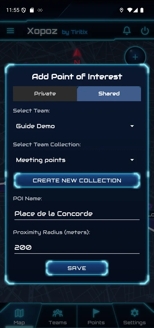
- Move the map so the centre cross is over the place you want to save — or use Search Location to jump to exact coordinates.
- Tap the Add Point of Interest button (flag) on the right side of the map.
- Choose Private or Shared at the top of the dialog.
- Private: select the collection (folder). Shared: select the team, then the team collection. Create New Collection creates a folder on the spot.
- Enter the POI Name and, if needed, change the Proximity Radius in metres.
- Tap Save. A message confirms the folder the POI was added to.
Private vs Shared POIs
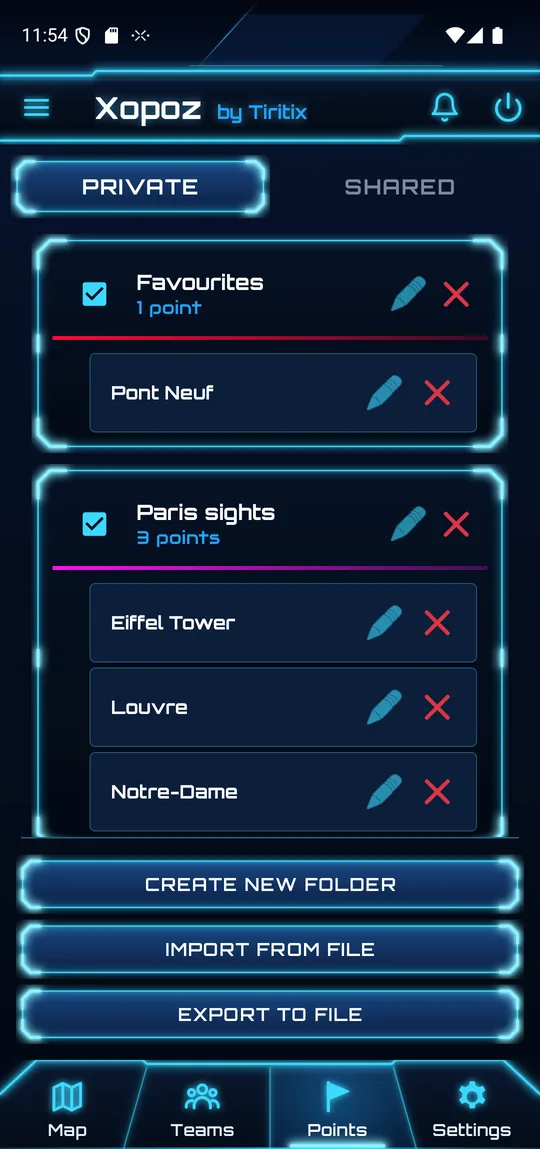
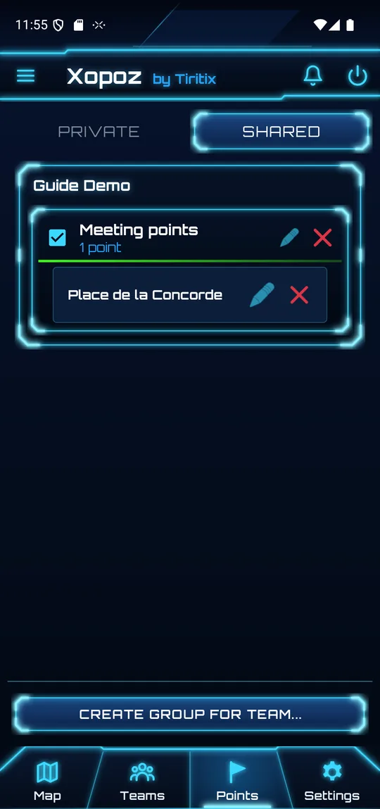
The Points tab has two tabs — Private and Shared. POIs are never created automatically — you must explicitly save each one.
| Private POI | Shared POI | |
|---|---|---|
| Visible to | Only you (across all your devices) | All members of the selected team |
| Sync | Synchronised across all your devices | Synchronised across all team members' devices |
| Collaboration | Personal use | Any team member can add, edit, or delete |
Folder Organisation
POIs are grouped into folders (also called groups or collections). Each folder card has:
- Checkbox — show or hide all POIs of the folder on the map
- Name and number of points — tap the header to expand or collapse the folder
- Pencil — rename the folder or change its colour
- Red cross — delete the folder
- Colour bar — the colour of the folder's flags on the map
Creating a Folder
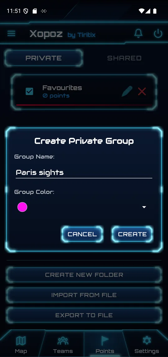
- In the Private tab, tap Create New Folder. For a team folder, open the Shared tab and tap Create Group for Team…, then select the team.
- Enter the group name.
- Pick a Group Color.
- Tap Create (or Create for Team).
Deleting a Folder
Tap the red cross on the folder header. The confirmation tells you how many points will be deleted with it — for example “Delete folder and permanently delete all 3 points inside? This cannot be undone.”
Moving POIs Between Folders
You can reorganise POIs by dragging them between folders.
- Long-press a POI until a drag shadow appears.
- Drag it over the target folder header — the header highlights.
- Release to move the POI. A confirmation message appears.
You can also change the folder in the Edit Point dialog (see below).
POI Actions
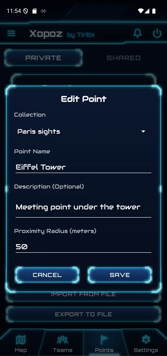
- View on Map — tap the POI name to centre the map on it
- Edit (pencil) — change the collection, name, description or proximity radius
- Delete (red cross) — remove the POI after confirmation
- Drag on Map — long-press the POI flag on the map for 1 second, then drag it to a new position. The location is saved automatically.
Backup & Restore
You can back up all your private POIs to a JSON file and restore them later — useful when switching devices or keeping offline copies.
Export (Backup)
- In the Private tab, tap Export to File.
- Choose a save location using the file picker.
- A timestamped file (
xopoz_points_backup_[timestamp].json) is created with your complete folder structure.
Import (Restore)
Tap Import from File and select a previously exported JSON file to merge it with your existing POIs. If duplicates exist, the newest version (by timestamp) is kept automatically.